
When people talk about the Rio Chama, a few things usually come to mind. The river is well known throughout the Southwest as a hot spot for rafters and anglers alike trying to getaway for the weekend. The river corridor is teaming with wildlife. Elk and deer can often be found looking for a place to browse and drink cold water from the river while migratory birds dwell in tall cliffs above. Georgia O’Keeffe appreciated the landscape’s beauty by painting the river’s famous sandstone bluffs and meandering turns. Benedictine monks have created a home within the Chama canyon believing its undisturbed qualities bring them closer to God. These natural, cultural, historical, and recreational values of the Rio Chama have provided a 31-mile stretch of the river to be designated as Wild and Scenic. While this designation has given much needed protection to the river, further analysis into the rivers history can also show it’s exploitation.
Manipulation and Protection
The Rio Chama saw it’s fair share of infrastructure throughout the 20th century. Three large dams and farm irrigation has affected much of the rivers free flowing qualities. El Vado Dam, built in 1933, inundated 3,500 acres of land as well as the whole town of El Vado. In 1963 the Abiquiu Dam was constructed creating further alterations to the rivers naturalness. Being just 12.8 miles from the Continental Divide made it a perfect candidate for the San Juan-Chama Project. Water is diverted from the San Juan River across the Divide and into Heron Reservoir, eventually flowing into the Chama. These large modifications of the Rio Chama’s flow were built with little thought to the rivers health and sustainability. Natural floods have been eliminated, which fostered much of the rivers vitality and ecosystems.
Fortunately, just 7 years after the construction of the Heron Dam, The Chama River Wilderness was designated in 1978, providing protection to a large part of the river and surrounding areas just North of Abiquiu Reservoir. A decade later, further protection was granted, when a 31-mile section of the river was established as a Wild and Scenic. While these protections would prevent further dams and roads to be established within the Wilderness and Wild and Scenic areas, the damage created by the infrastructure is permanent. Whole ecosystems dependent on the natural qualities of the river would have to adapt or disappear.

A Novel River
Now regulated by unnatural forces the Rio Chama presented a unique opportunity for scientists to study the river’s flow and how it effects the ecology of the river. The Rio Chama Flow Project was created to study the optimal flows needed to ameliorate the social and ecological benefits on the 31-mile stretch between the El Vado Dam and Abiquiu Reservoir. Scientists hope that by controlling dam releases, they can restore ecological sustainability, sediment transport, and river channel dynamics, to the state it was before the dams were built. By mimicking the floods that had existed ions prior to the altercations of the river corridor, the Rio Chama Flow Project’s end goal is to create a healthy river while still utilizing the river’s flow for it’s social, and recreational purposes it is used for today.
Exploring The Rio Chama
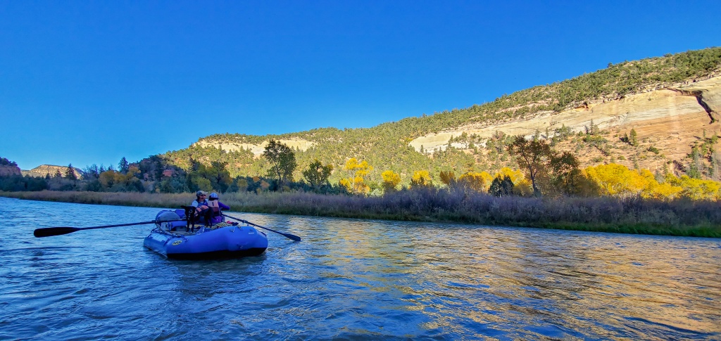
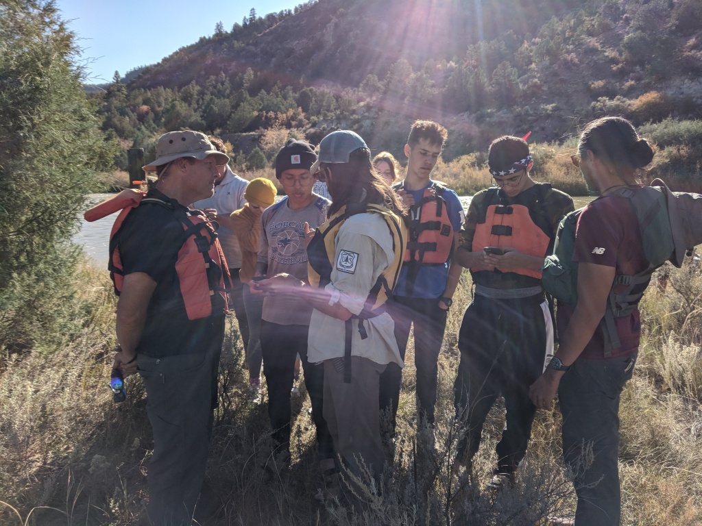
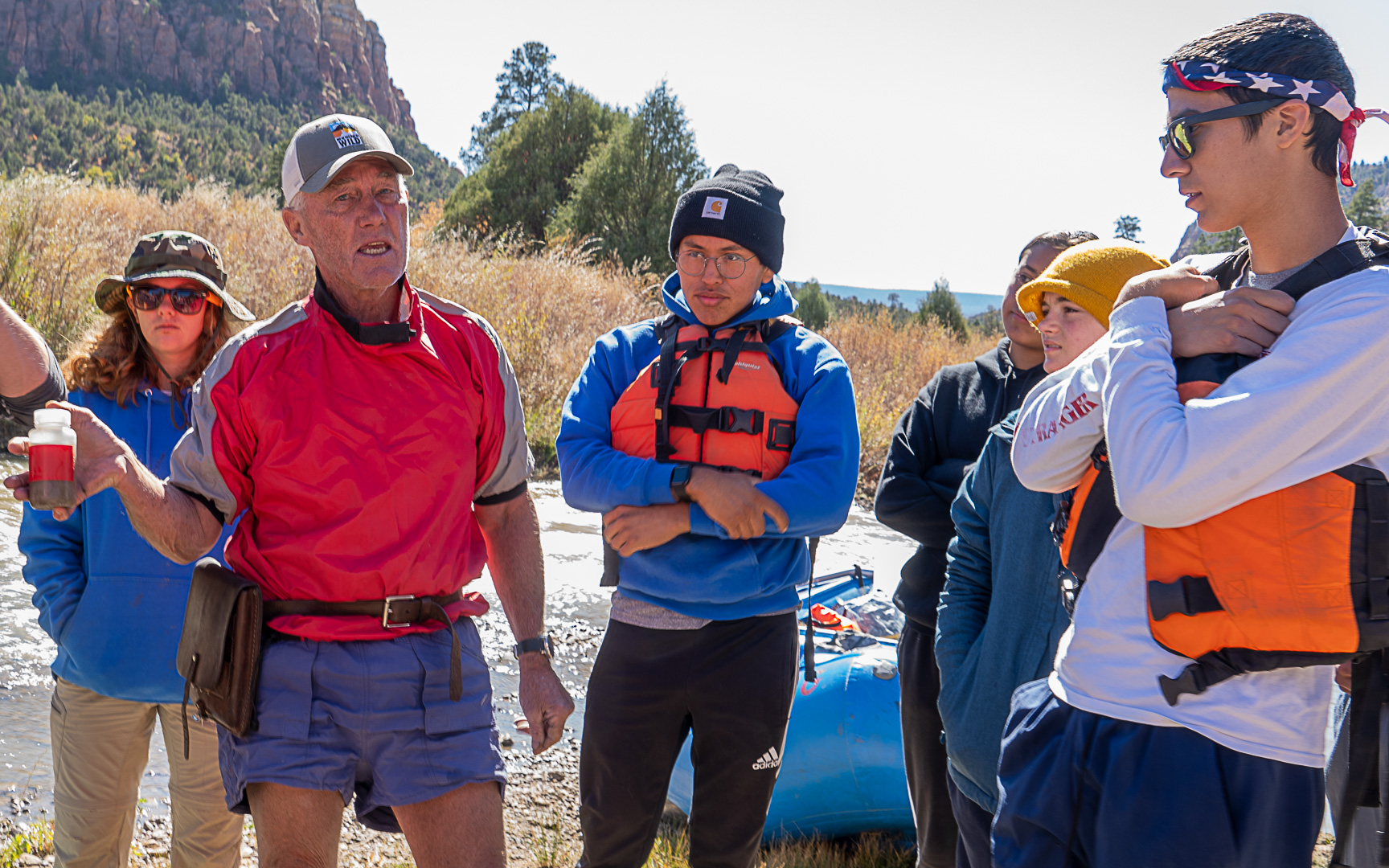
The uniqueness of the Rio Chama has provided a wonderful chance for experiential education. New Mexico Wild, in partnership with the National Forest Service, Bosque Ecosystem Monitoring Program(BEMP), and Rio Grande Restoration, were able to take 9 BEMP students down the Wild and Scenic stretch of the Rio Chama to study and explore the river’s special qualities. With the help of students, Wilderness Rangers were able complete a riparian invasive plant survey, as well as engage with students in importance of Wild and Scenic Rivers Act as a whole. Rio Grande Restoration provided gear rafts as well as the aforementioned scientists that worked on the Rio Chama Flow Project.


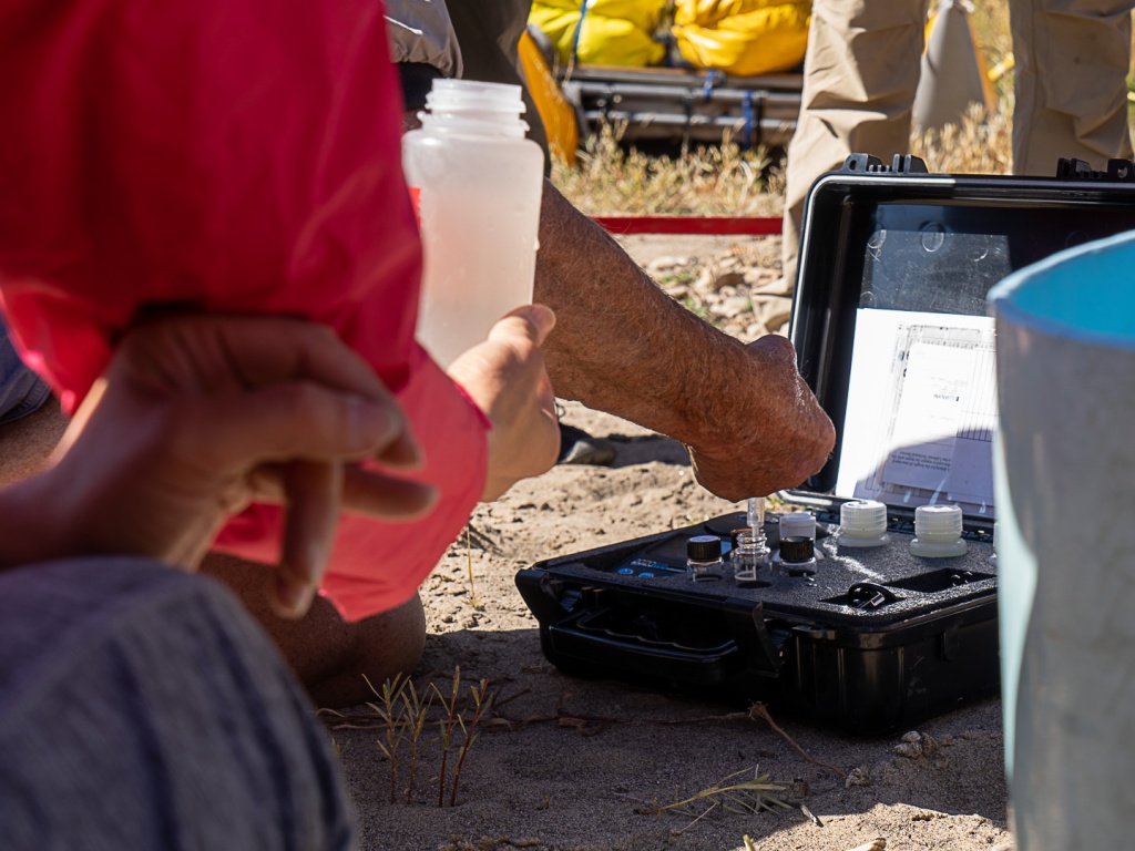

Through the training of the New Mexico Wildness Rangers, the students learned about riparian invasive plant species and its impact on native plants within the corridor. Furthermore, students learned how to document and survey the invasive species with the understanding that this information would eventually lead to their removal or further examination. Members of the Rio Chama Flow Project, all from different scientific backgrounds, taught the students about the ecological, hydrological, and geological components of the river corridor and its immediate impact on the health of the river and its ecosystems.
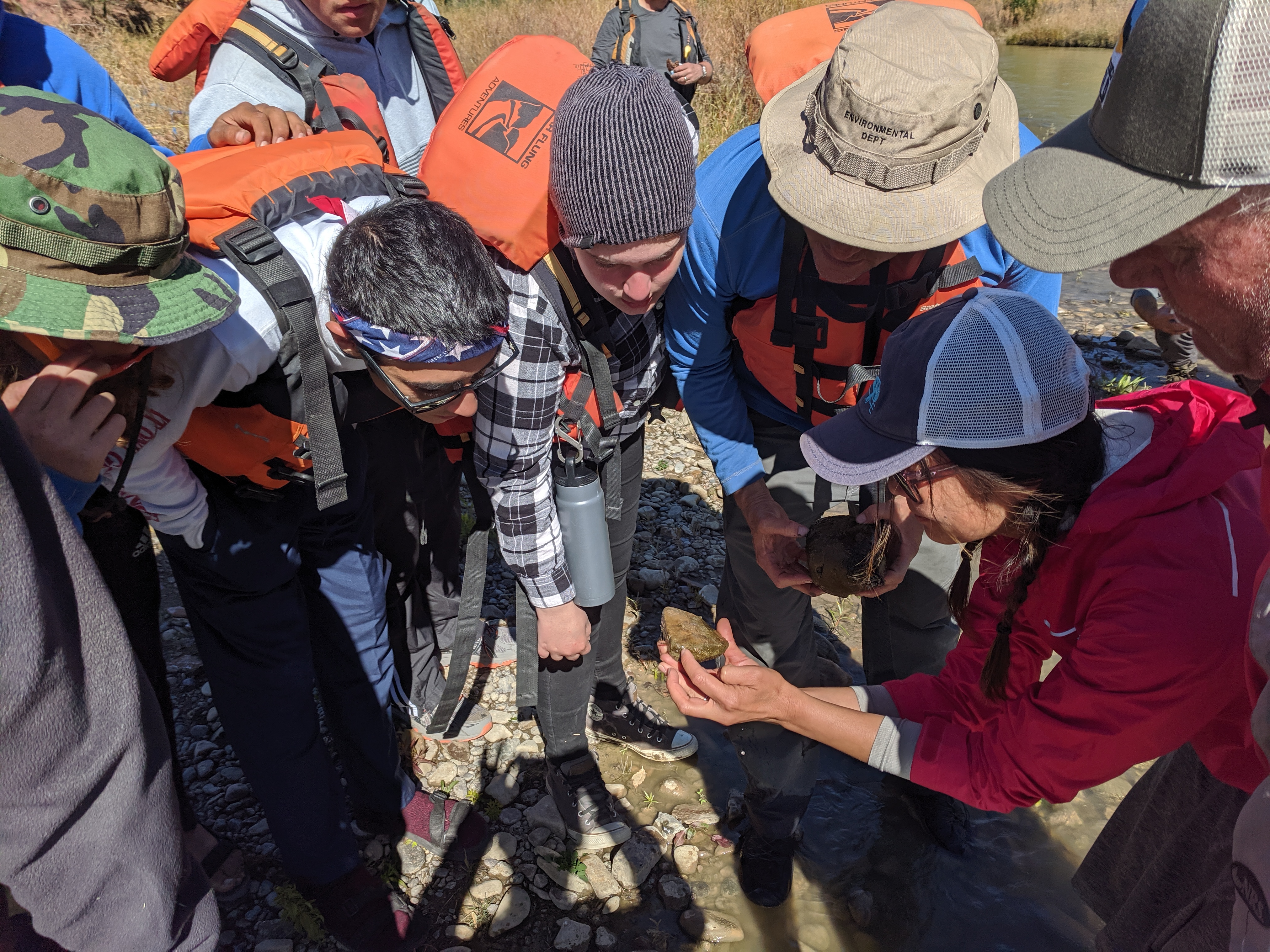
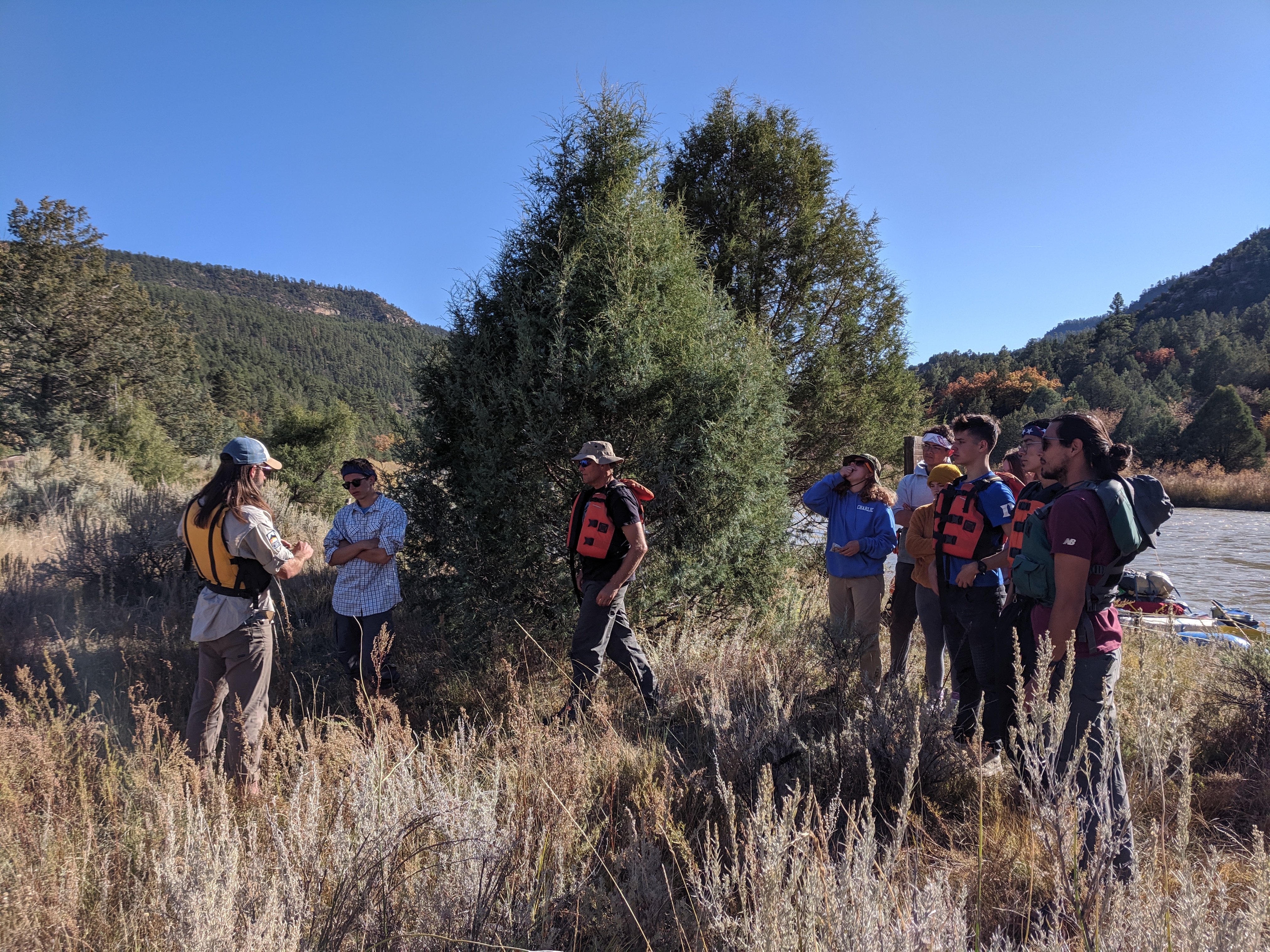
Students also got to experience the many features the Rio Chama Wild and Scenic River and surrounding Wilderness have to offer. Wildlife sightings and examining fossilized dinosaur footprints tied the students in to the surrounding terrestrial environment that contributes to the river corridor. By reflecting on their time on the Rio Chama, we hope the students will further their respect and knowledge of Wild and Scenic Rivers within the United States.

Acknowledgements
We would like to thank all of our funders and partners that were able to put this trip together. Thank you to the River Network for providing opportunities for Wild and Scenic River Stewardship and helping us fund this project. Thanks to Will Ribbans at New Mexico Wild for leading and initiating such a project. Katie Elder, for leading and providing 9 BEMP students to take on this awesome adventure. A special thank you to Mike Harvey, Todd Caplin, and Mark Stone for their expertise on the river and their work on the Rio Chama Flow Project and to Asa Stone, and Rich Schrader for their wonderful company and helping get everyone down the river safely.
