By Kat Jacaruso | Las Cruces Sun-News
September 19, 2021
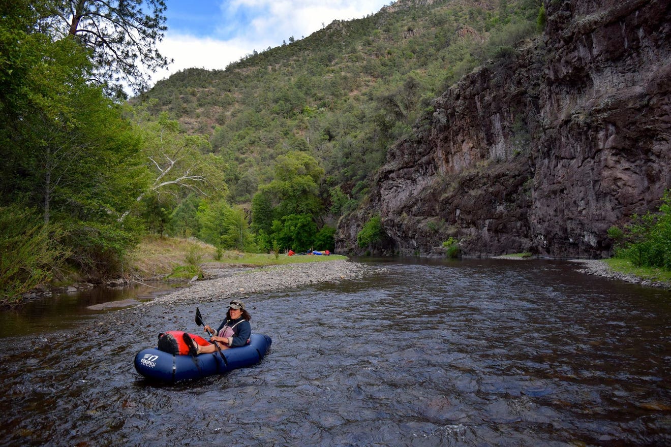
On a hot, stagnant day in May 2016, our team set off on a trip that had been two years in the making. The 16- day expedition would string us along the last free flowing watershed in New Mexico, the Gila River. Our packrafts — inflatable boats designed to reach remote places — would serve us well for the varied 87 miles of trails and water.
Our group of four college students were driven to pursue adventure in the Gila Wilderness because this wild river was in danger. The Gila River Diversion Project, a proposal to dam the Gila River, had been threatening the watershed since 2004.
The thought of navigating the wild Gila by packraft, for perhaps the last time, captivated us. But more motivating was the hope that our stories would join the countless others shared by stewards of this special place, articulating the value of the greater Gila ecosystem and catalyzing some measure of protection.
The Gila is an example of how, without rigorous levels of protection afforded through legislation like the Wild and Scenic Rivers Act, even land and rivers that have been protected in the past are vulnerable to power grabs that are not in the interest of local communities.
My first days in the Gila Wilderness were remarkable. The early, clear sunlight beamed me into what felt like another country as we approached the trailhead. The ponderosa pines and rounded river stones designed new memories for me, architecture guided by new smell and sight, intriguing and raw.
Navigating along Turkey Feather Creek and then into our packrafts for the larger Gila River drainage, we travelled through time and space slowly. Each cup of tea we brewed signaled another day of finding our way through the wild. We struggled to imagine a diverted Gila River, and felt sorrow over the possibility of losing this powerful river.
While in 2016 the threatened Gila River drew us in, now, five years later, the Gila River Diversion Project has crumbled. This spring marked the end of an era for the Gila River Diversion Project with the passage of House Bill 200 and the defunding of the New Mexico Entity of the Central Arizona Project. Even still, the Gila River communities rise to defend their source of livelihood, pleasure and environmental health, setting sights on the Wild and Scenic designation.
After years of community-led groundwork, the bill to incorporate the Gila River into the National Wild and Scenic Rivers System was originally introduced in the 116th congress in 2020, and now must be introduced again by Sen. Heinrich and Sen. Luján.
Fortunately, the Gila River and its tributaries nourish a diverse group of local stakeholders who are ready to protect what they find valuable within. Free flowing, the Gila is a dynamic and powerful resource. The anglers, hikers, business owners, veterans, landowners, ranchers, paddlers, older folks, and us — the kids — agree.
One powerful lesson learned from my time on the Gila River is that threatened rivers require some of the same healing remedies as humans under threat: attention, time investment, allocated resources, nourishment and love. Safeguarding our beloved river systems gives us a chance to provide them that treatment.
Kat Jacaruso is a steward of the Snake River in Wyoming.
This guest column originally appeared in the Las Cruces Sun-News.